Diagnostic··8 min read
Signs Your Canal Needs Dredging: South Florida Guide
If your boat hits bottom, your lift won't lower fully, or you're seeing new shoreline vegetation — your canal may be due for dredging. Eight signs every South Florida waterfront owner should know.
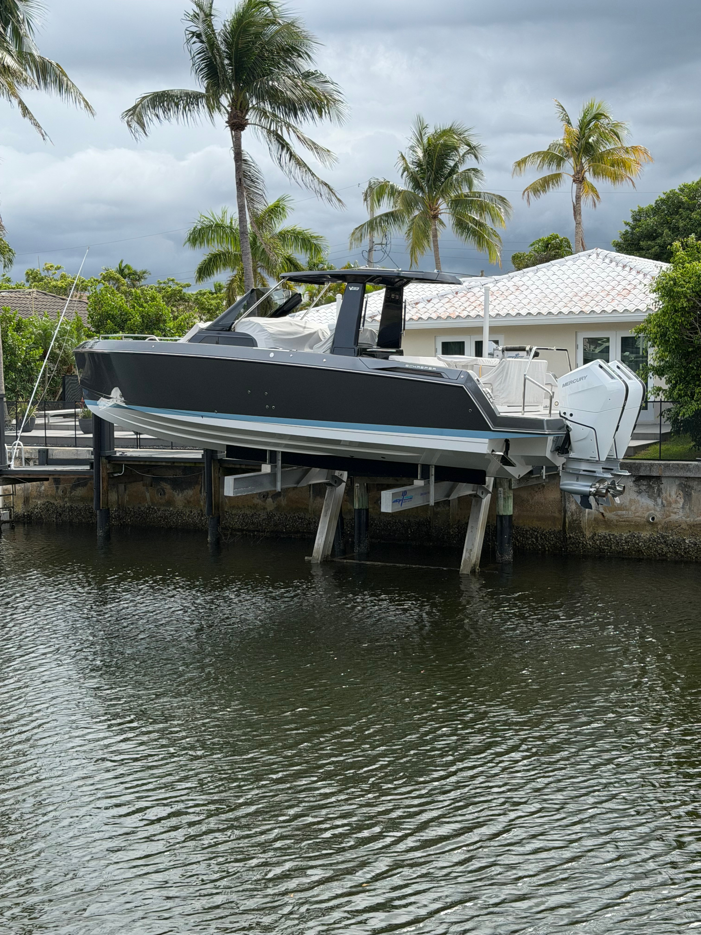
Most waterfront owners in Palm Beach and Broward counties don't realize their canal needs dredging until their boat hits bottom — and by then, the problem has been building for years. Shoaling happens slowly, then suddenly. As a licensed marine contractor working canals across South Florida, we get the same call every week: "It used to be deeper here. What happened?"
This guide walks you through the eight signs your canal or boat slip needs dredging, why South Florida shoaling happens faster than most owners expect, and when to call a contractor versus when you can wait. If you've already noticed one or two of these symptoms, you're probably overdue.
The eight signs your canal needs dredging
These signs are ordered from most obvious to most subtle. If you're seeing three or more, you're past the point where waiting saves money.
1. Your boat hits bottom at low tide
The most obvious sign — and the one that finally forces most owners to act. If you're hearing a thunk or feeling resistance at low tide where you used to clear comfortably, sediment has built up to within inches of your hull. This is a problem that gets worse on a curve, not a line: the same shoaling that's costing you six inches today will cost you eighteen inches after one hurricane season.
2. Your boat lift won't lower fully
Boat lifts are calibrated to a specific bottom depth. When sediment builds up under the lift, the cradle hits the new bottom before fully lowering — and your boat sits crooked, hangs at an angle, or just won't release. If your lift operator is asking you "did something change?" the answer is the bottom changed.
3. You're losing usable depth at the dock face
Check the depth right next to your seawall or dock face at mean low water (the lowest predictable tide of the day). Compare it to your original survey or permit drawings if you have them. A loss of 12 inches or more from the design depth means you've lost a meaningful percentage of your basin and the trend is going to continue.
4. Sediment is visible above water at low tide
If you can see mud, sand, or sediment bars exposed in your canal at low tide, that material is sitting above your waterline — meaning the rest of your bottom is much closer to the surface than it looks at high tide. Once sediment surfaces, you've crossed an important threshold: the canal is no longer self-flushing in that area.
5. New vegetation is growing in your basin
Seagrass, algae, and shallow-water plants only colonize where there's enough light reaching the bottom. If you're seeing new vegetation growing in places it didn't grow before, the bottom has risen enough to receive light it previously didn't. This is also a permitting complication — once protected vegetation establishes, dredging it out requires additional environmental review.
6. Murky or cloudy water that doesn't clear
Healthy, deep canals self-clear after a storm or heavy boat traffic within hours. If your canal stays murky for days after disturbance, it likely means the water column is so shallow that any movement re-suspends sediment from the bottom. That's a depth problem, not a water quality problem.
7. Your neighbors have already dredged
Canals are connected systems. If neighbors on the same waterway have recently dredged, you may have benefited briefly — but sediment moves with tides and current, and what was removed from their slip often migrates back. Even if your basin looks fine today, you're probably 2–4 years behind their schedule.
8. A bathymetric survey shows you below original design depth
This is the definitive answer. A bathymetric survey produces a depth plot tied to NAVD88 (the official elevation reference for Florida coastal work), which can be overlaid against your original permit drawings. Any reputable contractor — including us — will run this as the first step before quoting any meaningful project. If you don't know your current depth, you don't know what you need.
Why South Florida canals shoal faster than most
Canals from Jupiter down to Hallandale Beach silt in faster than canals in most other parts of the country. There are five reasons:
- Hurricane and storm scour. Major storms move enormous volumes of sediment. A single Cat-3 storm can dump 1–3 feet of new material in a residential canal — sometimes more. Florida averages a major storm impact every 3–5 years.
- Tidal sediment transport. The Intracoastal pumps sediment in and out of every connected canal twice a day. Over time, finer sediments settle in slow-current zones — exactly where most private docks sit.
- Prop scour from your own boat. Every time you back out of a slip or maneuver at low speed, your prop kicks up sediment from the bottom. That sediment doesn't disappear — it redistributes within the same basin, often piling up near your seawall face.
- Stormwater outfalls. Municipal drainage pipes routinely empty into residential canals, carrying sediment from roads, lawns, and construction. If there's a storm drain near your property, you're catching everything upstream of it.
- Mangrove and seagrass loss. When shoreline vegetation dies off (often from boat wakes, herbicide, or development), it stops trapping sediment naturally. That sediment migrates downstream into private basins.
This is why South Florida canals typically need maintenance dredging every 7–15 years — sometimes more often for canals near storm drains, marina entrances, or fixed bridges that constrict tidal flow.
What "design depth" means — and why it matters legally
Every navigable canal in Florida has a "design depth" — the depth at which it was originally permitted, dredged, and approved. Design depths are referenced to NAVD88, the North American Vertical Datum of 1988, which is the standard elevation reference for all permitted coastal work in Florida.
Why this matters: you're generally only permitted to restore your canal to its original design depth — not deeper. Dredging below original design depth requires a new permit application, additional environmental review, and (often) mitigation. This is true under FDEP rules and is reinforced by USACE oversight for canals connected to navigable waters.
If you don't have your original permit drawings, your contractor (or a marine surveyor) can usually pull them from county records or work with FDEP to establish design depth from historical records. Skipping this step is the most common reason dredging projects get held up in permit review.
When to call a contractor vs. when to wait
Honest answer: most owners wait too long. The reason is that the cost of shoaling is invisible until it becomes a hard limit on your use — and then it's already an expensive problem.
Call now if:
- You've hit bottom in your slip in the last 12 months
- Your boat lift no longer cycles fully
- A storm has hit your area in the last 24 months and you haven't surveyed since
- You're planning to sell within the next 18 months (depth surveys are a buyer leverage point)
- You're planning seawall, dock, or lift work — combining dredging with that scope cuts the cost meaningfully (one mobilization, one permit cycle)
It's reasonable to wait if:
- Your most recent bathymetric survey is under 3 years old and you're still well above design depth
- You don't use the slip and have no resale timeline
- No major storms have hit your area since your last survey
The mistake we see most often: waiting through another hurricane season "to see what happens." What happens is more sediment, more shoaling, and a bigger eventual project. Dredging gets more expensive per cubic yard as volumes increase — so the "wait it out" approach usually costs you more, not less.
What happens after you call
The actual process is more straightforward than most owners expect. From first call to mobilization is typically 4–7 months, with most of that calendar belonging to permit review, not field work.
- Site visit (no cost, scheduled within a week of your call). We meet you at the property, walk the shoreline, and discuss what you're seeing.
- Bathymetric survey (1–2 days of field work). A single-beam sonar survey produces a current depth plot referenced to NAVD88.
- Preliminary scope (1 week). Based on the survey, we draft a sediment volume estimate, permit pathway, and proposal.
- Permit submission (2–3 weeks to prepare and file). FDEP, USACE, and county or municipal permits depending on scope.
- Permit approval (8–14 weeks under standard review, faster under emergency rule if you qualify).
- Field work (2–5 days for residential, longer for larger scopes).
- Closeout survey (1 day). A post-dredge bathymetric survey confirms restored depth, signed and sealed.
The whole process is something we coordinate end-to-end — including the permit filings, engineer-of-record relationships, and disposal logistics. You sign one contract.
The bottom line
If you're seeing three or more of the signs above, your canal is past due for an honest assessment — not necessarily dredging, but at minimum a survey that tells you where you actually stand. The cost of shoaling is invisible until it's a hard limit on your use, and by that point you've usually lost the option to handle it as a maintenance issue instead of a capital project.
Next step: request a no-cost site visit. We'll walk your shoreline, talk through what you're seeing, and tell you honestly whether you need to act now, wait 12 months, or schedule a survey first.
Call 754-SEA-WALL or email alex@sflseawall.com.
Frequently asked questions
- How often should I check my canal depth?
- A bathymetric survey every 3–5 years is reasonable for most South Florida residential canals — sooner if a major storm has hit your area. If you're already past 10 years since your last dredge, you're likely past the point where you can rely on visual checks alone.
- Can I just check the depth myself with a fishfinder?
- For a rough indication, yes. A fishfinder will tell you whether you've lost depth versus what you remember. But it won't reference NAVD88, won't compare against design depth, and won't produce a record a permit reviewer will accept. For any real project, you'll need a formal survey.
- Will a bathymetric survey damage my dock or seawall?
- No. A survey is non-invasive — a small skiff with sonar, moving slowly around your basin. The boat doesn't touch the bottom, the dock, or the seawall.
- What does just a survey cost?
- For a single-property residential basin, a standalone bathymetric survey is typically a few hundred to a few thousand dollars, depending on size and complexity. If you proceed with dredging, the survey cost is usually absorbed into the project total. Ask the contractor up front how they handle this.
- Does my HOA need to be involved?
- If your canal is HOA-owned or shared with neighbors, yes. Most HOAs have covenant requirements around shoreline modifications, and many have shared maintenance responsibilities for community waterways. We routinely present scope and budget to HOA boards before any work begins.
- What if my neighbor dredged and I didn't?
- You probably benefited temporarily, but the sediment that was removed from their basin is now redistributing through the connected waterway — including, eventually, back toward yours. Coordinated dredging across adjacent properties is meaningfully cheaper per cubic yard than running multiple separate jobs. If your neighbors are considering it, talk to each other first.